Today, Bankside is a popular destination for a night out or a saunter on the weekend, with Borough Market around the corner, as well as the many cafes, pubs, and restaurants. It is also often used in television and film, including Dr Who and Bridget Jones’s Diary! However, Bankside is also one of the most historic parts of London and has been through an extraordinary transformation over the centuries, from fields, to a Tudor and Stuart red-light district and theatre land, through to a busy Victorian industrial enclave. It may be a cliché, but Bankside really is ‘jam-packed’ with history!

The lower part of this drawing by Wenceslaus Hollar shows Bankside at the time of the Civil War, with the Bishop’s house and gardens to the bottom left and the theatres and entertainment venues behind, along with the old London Bridge to the right.
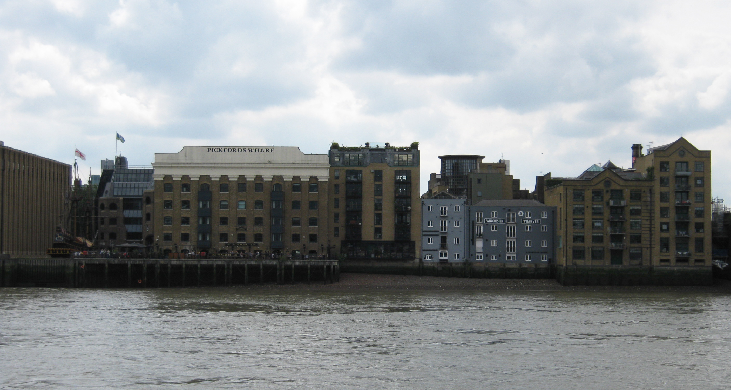
A short time ago, while I was with Chestertons estate agents, I was asked to research one of the more recent apartment buildings that had been built on the site of an old warehouse called Horseshoe Wharf. It is situated across from the remains of the Bishop of Winchester’s 14th century palace, and despite the young age of the current building, the site has a history going back to the 12th century.
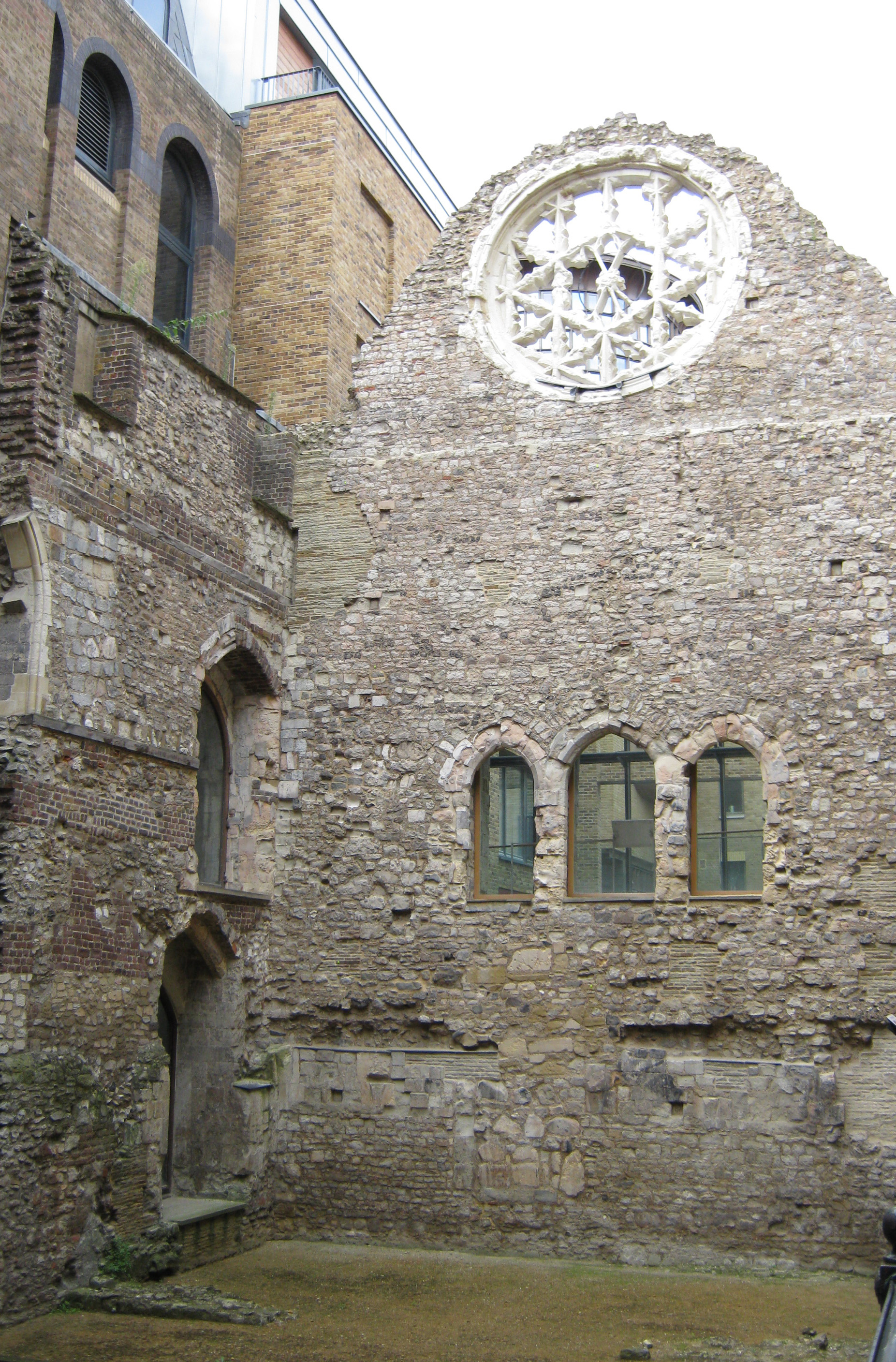
Bankside has been occupied from as far back as the Romans in the 1st century, but an archaeological study of the site of Horseshoe Wharf revealed it was occupied from the 12th century – at exactly the same time that the Bishop of Winchester was establishing his home here by the banks of the Thames.
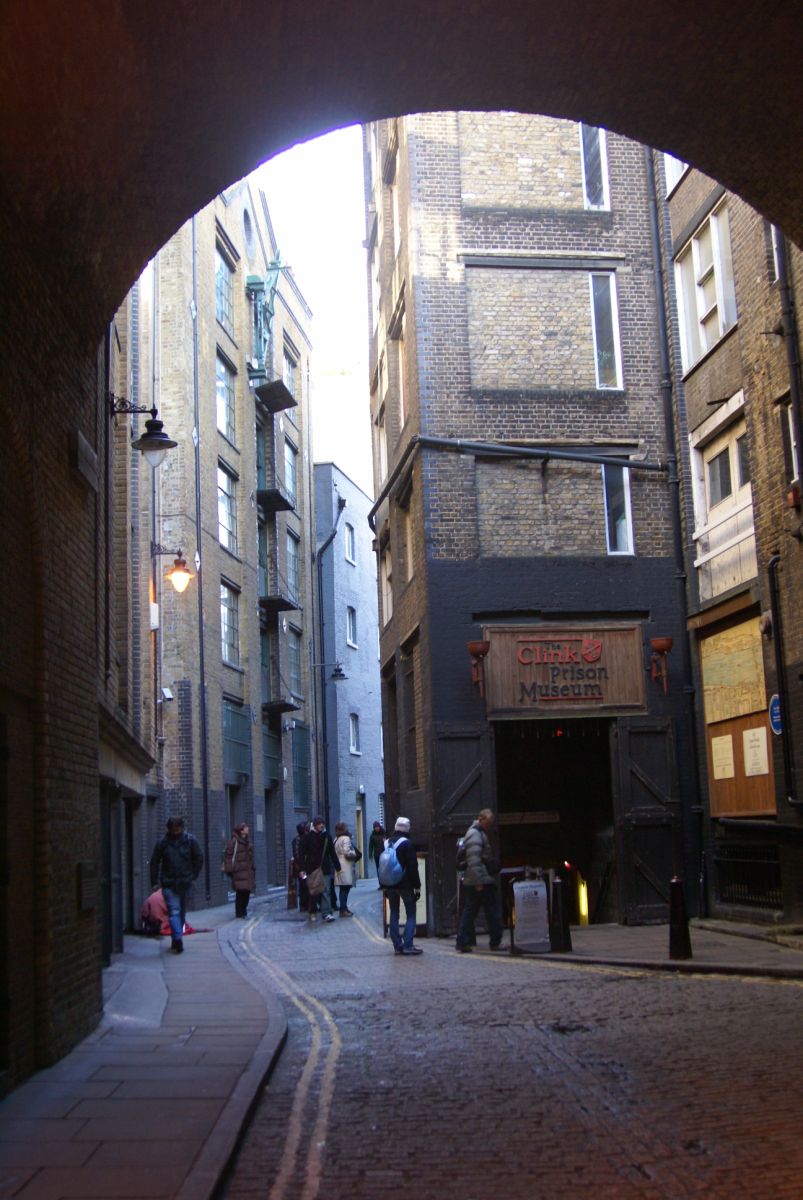
The Bishop of Winchester was the lord of the manor, separated from The City across the river, which meant he had his own court, and even his own prison – the infamous ‘Clink’. It formerly sat to the west of Stoney Street and eventually gave its name to the area, so it became known as the manor of the Clink. The Clink was one of the worst prisons in London, where prisoners were left to starve or even literally left to rot or drown in the rising tide. The name of ‘The Clink’ is believed to have originated from the word for keyhole, but it is also commonly thought to originate from the ‘clinking’ of keys. Whatever the origins, the name is now synonymous with the name for prison.
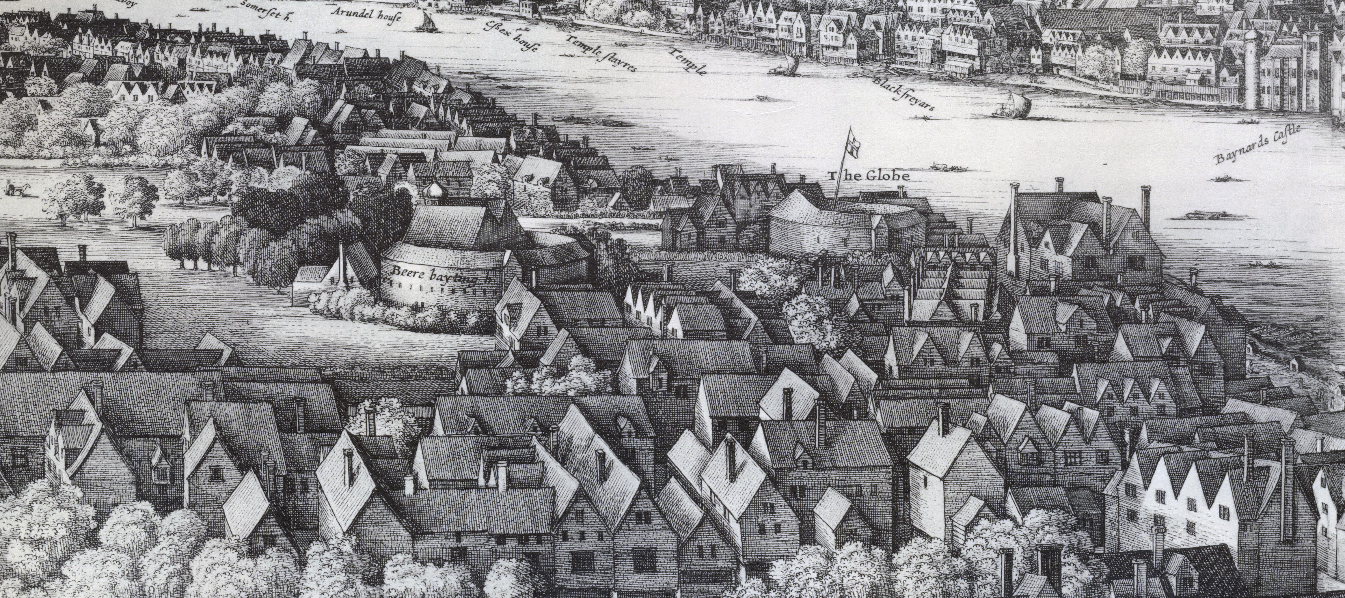
A closer look at the drawing by Wenceslaus Hollar also reveals Shakespeare’s Globe Theatre and a Beere Bayting [sic] ring. During the 16th and 17th century, this part of London was notorious for its entertainments, with taverns, theatres, and brothels. Being outside the jurisdiction of the City of London, many came to the south side of the river, which became known as the ‘playground of the City of London’. It was also the original red-light district when Soho was just fields.
A revetment was first built along The Thames at Bankside in the 14th century, but it was in the late 16th and early 17th century that a stone wall was built (which corresponds with the time that a great many people were coming across the river to visit the taverns and theatres). The new wall also allowed for sturdier construction of houses and tenements, which were built around the time of Hollar’s drawing in the 1640s. The name of Clink Street also first appeared at this time. However, within 150 years most of these early houses were demolished and a new brick river wall constructed, which led the way for the tall warehouses and wharf buildings we recognise today.
It was at this time, in the late 18th and 19th centuries that industry took over the riverside. The first building named Horseshoe Wharf was built in 1837 and by 1838 was occupied by lighterman, John Raymond. Lightermen operated the small flat-bottomed boats known as ‘lighters’ that transported goods from the ships in The Thames to the quays. John Raymond & Son were recorded at Horseshoe Wharf for almost 40 years until the 1870s.
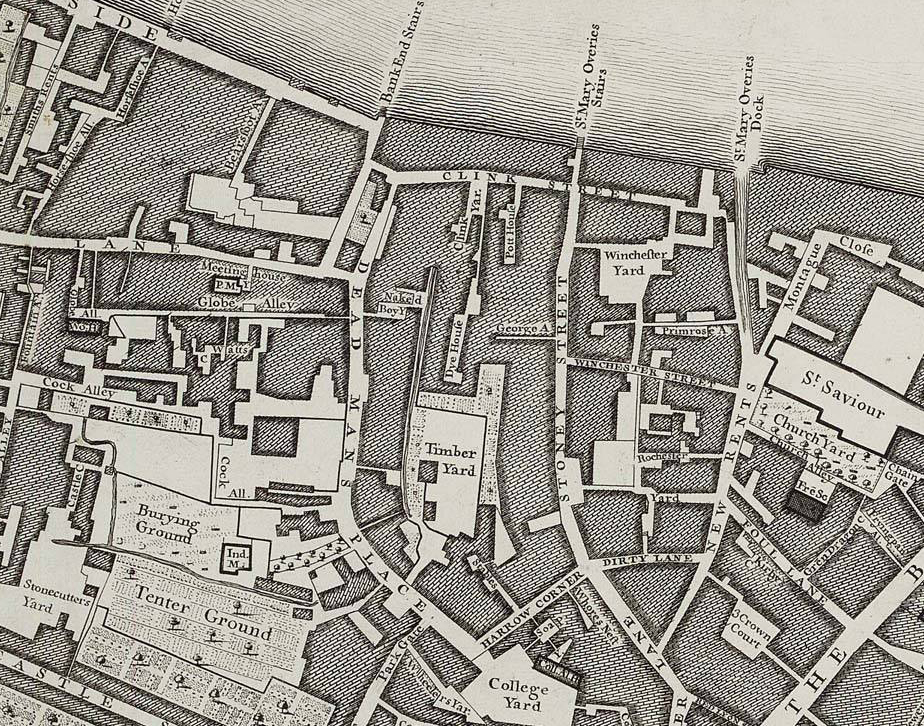
From the 1880s through to the 1930s, Horseshoe Wharf was occupied by a variety of businesses, including Doo Brothers lightermen, John Muir & Company, corn merchants, and Coombe Gordon & Co., granary keepers. It continued as a warehouse building after the Second World War, but by the 1990s the site of Horseshoe Wharf was chosen for a new apartment building. After the demolition of the old building, English Heritage had the unique opportunity to undertake an archaeological study before the foundations for the new building were put in place, revealing the fascinating details about the early settlements, as well as the evolution of the riverside walls and the story of one of the most historic parts of London.


In Hollar’s map of 1647 he has labelled the Globe theatre and bear baiting ring the wrong way round. The bear baiting ring was actually the structure closer to the river. In the map the other building clearly has a roofed ‘tiring house’ on top of it which the actors used to change costumes. This would not have been necessary on a bear baiting ring. It is thought that this mistake came about because he produced the map in Antwerp based on sketches he had made when in London, in which he had presumably forgotten to label the two buildings, and made the wrong guess.
It is particularly worrying that the shape and dimensions of the New Globe Theatre were supposedly decided on in the 1980s partly after examination of the structure in Hollar’s map. Let’s hope they realised which one it was!
Hi Gillian
Thank you for the details about Hollar’s map – it’s always good to remember that sources may not always be precise. I’d like to think the designers of the new Globe Theatre would have checked :-) Thanks again! Mel
Was lovely to find this article. Have just bought an apartment in Horseshoe Wharf & would like my wall art to reflect its history.
Would love to access old maps, photos and any other info available.
Many thanks
Maggie
Hi Maggie
Thank you for your comment. The best place to get old maps, photos, and other details related to Bankside and Horseshoe Wharf is in the Southwark Archives. All their details are here – https://www.southwark.gov.uk/libraries/local-history-library-and-archive/visiting-the-local-history-library-and-archive – Alternatively, you can find some more information at the London Metropolitan Archives, but I would contact Southwark first and they can help you :-)
All the best,
Mel